Climbing Bukhansan
A granite national park inside the city limits — ride the subway to the trailhead, haul the cables to Baegundae, see all of Seoul.
The short version
- Bukhansan is the national park Seoul kept inside its own boundary — granite domes, fortress walls, and forest, reached by subway and a short city bus; trail maps and notices at english.knps.or.kr. Entry is free.
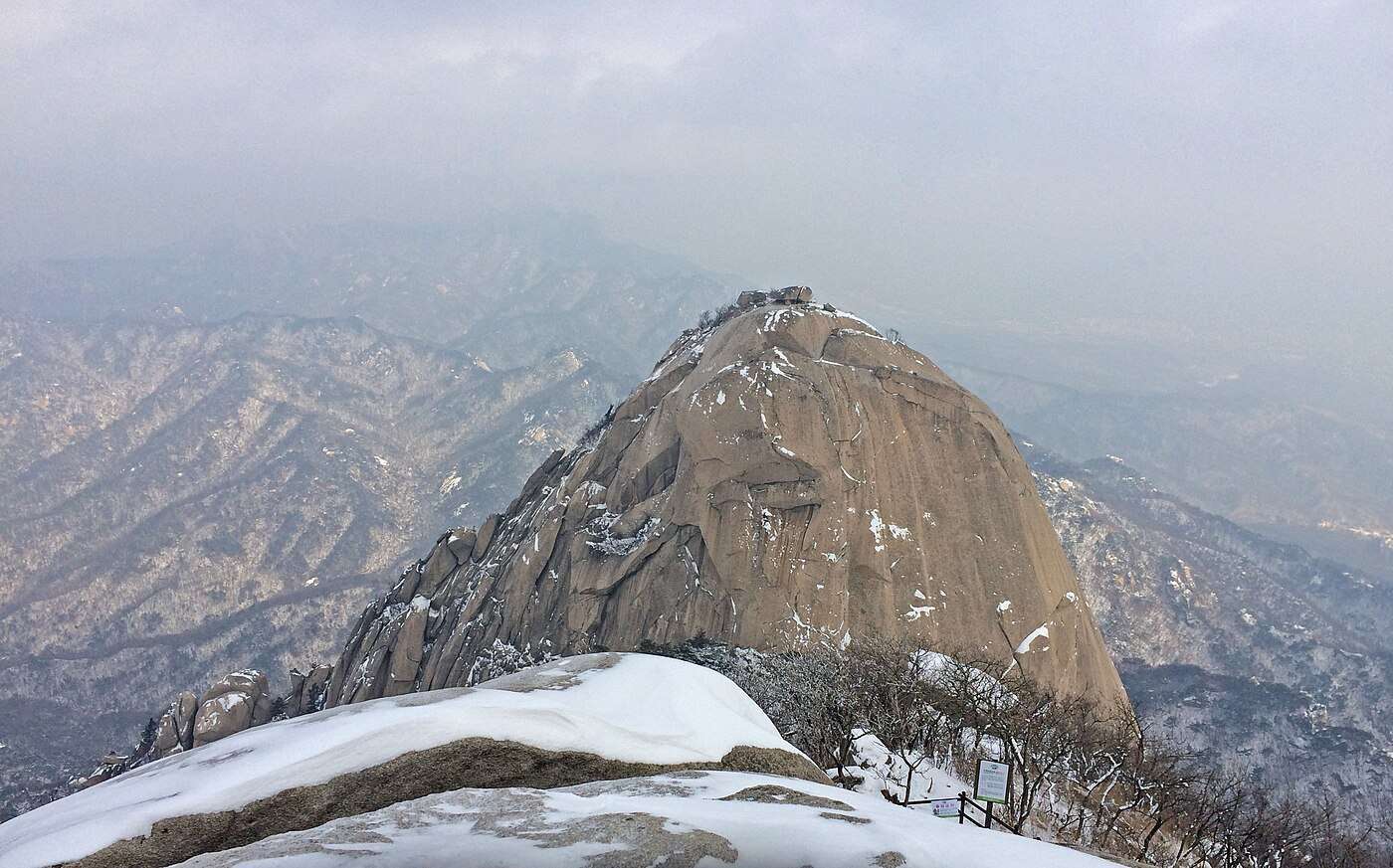
- Baegundae, the 836-metre summit, is the classic: from the Bukhansanseong entrance, a steady two-hour climb through the fortress gate, past Insubong’s sheer dome where climbers dangle, to the final granite slab where steel cables and your own grip finish the job.
- The last stretch is a hands-on scramble in traffic — Koreans treat the cables like a national queue — and the top is a bare dome with a flagpole and a 360-degree audit of the city: towers south, DMZ ridges north, and the fortress wall stitching the ridgeline below.
- Bukhansanseong — the 1711 fortress whose 9.5-kilometre wall still laces the park — gives the mountain its history and its gate; the wall-side paths make gentler alternatives when the summit queue does not appeal.
- Hiking is Korea’s national sport and the park its most-visited stage, with a Guinness-certified crowd record to show for it — which is why weekday mornings exist. The gear-perfect ajummas who overtake you on the cables have done this a thousand times; let them pass and learn.

Getting there
Take Line 3 to Gupabal, then bus 704 to the Bukhansanseong entrance — about an hour all told from central Seoul, which remains the whole miracle of this park. The trail through the fortress gate to Baegundae runs roughly 4 kilometres and two hours up at mortal pace. Alternative entrances — Bukhansan Ui station on the Ui LRT for the Baegundae approach from the east — spread the load; every route ends at the same cables.
The day
Through the fortress gate by mid-morning, climbing stone steps and forest switchbacks as the granite domes assemble overhead. Insubong’s wall appears first — binocular-worthy if climbers are on it — then the ridge opens and the cables begin: twenty minutes of hands-and-feet up the summit slab, flag in sight. On top, the full inventory: Seoul’s towers in haze, the Han glinting, ridgelines stacking north toward the border. Descend the same way or loop via the wall paths, and end where every Korean hike canonically ends — at the trailhead village’s pajeon and makgeolli tables, where limping is a badge and the pancake tastes better for the summit behind it.
When to go
October and November are the kingdom: crisp air, maple and oak turning the lower slopes, and summit visibility that makes the DMZ ridges legible — also the biggest crowds, so go midweek. Spring runs cooler and quieter; summer is green, humid, and thunderstorm-prone by afternoon; winter summits are spectacular and strictly for spikes-and-experience. Mornings beat afternoons for haze in every season.
Frequently Asked Questions
How do you get to Bukhansan by subway?
Line 3 to Gupabal plus bus 704 to the Bukhansanseong entrance is the classic Baegundae approach — about an hour from central Seoul. The Ui LRT’s Bukhansan Ui station serves the eastern route up.
How hard is the Baegundae climb?
A steady two hours up with a final 20-minute cable-assisted scramble on bare granite — strenuous but non-technical, done daily by every age group in Korea. Grip gloves, water, and real shoes cover the requirements.
Is the park really free?
Yes — Korea’s national parks dropped entry fees years ago. You pay only for the bus, the gloves, and the post-hike pancake.
How crowded does it get?
On fall weekends, record-settingly — the park holds a Guinness certification for visitors, and the summit cables queue like a polite escalator. Weekday mornings deliver the same mountain at a fraction of the density.
What is the fortress on the mountain?
Bukhansanseong, rebuilt in 1711 — 9.5 kilometres of wall and gates lacing the ridges, built to shelter the king if Seoul fell. The main trail enters through it, and wall-side paths make the park’s best gentler hikes.